If you’ve been reading the Push for Pipelines series of blogs, you’ve come across the call to “Learn More” about surveyor signs and symbols. Here you go:

A selection of typical surveyor tapes, also called flags or ribbons. Many other specialty color combinations are available to the professional surveyor.
It is not easy to interpret everything that surveyors leave behind, so here’s a simplified description of a variety of markings that are used by surveyors.
The three most commonly used markings are the simple stakes, flags and pins. These are used by all surveyors for any construction project anywhere, to guarantee that everything gets put in the right place. In an active gas field, these marking tools will be used for all aspects of exploration and production: access roads to well pads; widening the traveled portion of the roadway; well locations; ponds and impoundment locations; temporary water pipeline paths; surface disturbance limits; compressor stations; gas processing sites; right -of-ways for roads and permanent pipelines.
Quite frequently these simple markings are undecipherable by themselves, especially by a non-professional surveyor. We cannot know what is happening or likely to occur or how concerned we should be. Context and surroundings and additional information are usually needed. Sometimes the simple colors and combinations of colored tapes might only make sense in conjunction with similar markings nearby. Sometimes public notices in the newspaper and DEP permits must be used to decipher what is happening and what is planned.
For example, the proposed 30-inch diameter Ohio Valley Connector pipeline, which might have sullied my property, seems to be regularly marked using a combination of blue and white surveyor’s tape to mark the actual pipeline location and another green and white combination (see page 2 bottom) to mark all the proposed access roads along the routes to be used to get pipe trucks and excavation equipment into the right-of-way. These access roads or paths might be public roadways or across private leased property.
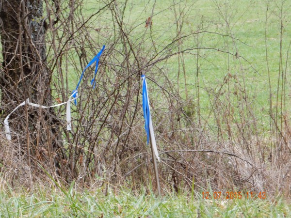
Simple surveyor’s flags or tape. Sometime the flags or streamers are attached to trees, fence posts or put on a stake to make them visible above the weeds. There might be no markings on the stake or only simple generic markings. This could mean that this is the correct road and turn here; or it could be a proposed or approximate location for some future work.
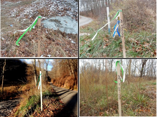
Stakes with simple flags and some basic identification. These stakes shown here all indicate an access route to be used for equipment and trucks to get to a proposed pipeline right-of-way. The “H310” is the EQT name for the proposed 30-inch diameter OVC pipeline.
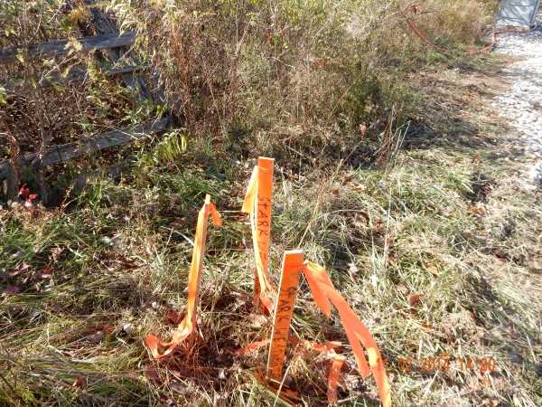
These three stakes are identifying a control point which is outside the limits of disturbance (LoD). These markings surround a pin to be used for reference.
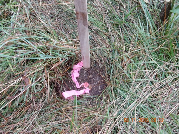
This stake is identifying a control point location. All control points will have some type of driven metal rod, usually with a plastic cap identifying the surveyor. Frequently there are three stakes with extra flags or tape. They are always set off to the side of the intended work area. They are not to be disturbed.
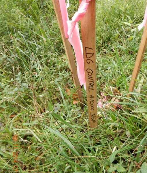
A set of three stakes marking a control point location. It is common to see triple stakes with elaborate, multiple flags. Even if there are only two stakes, there always will be a driven steel pin and identifying cap.
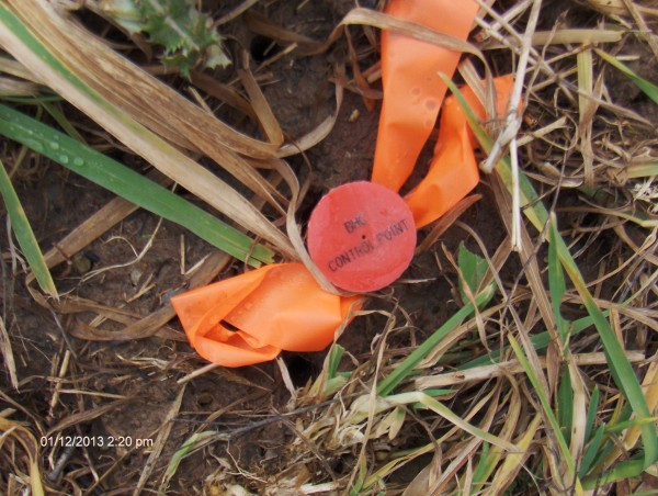
A close-up of the identifying cap on a metal driven steel pin. Control point locations are not meant to be disturbed as they are for future and repeated reference. They might give the latitude and longitude on the stake, plus the altitude.
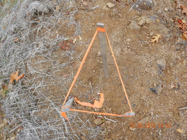
Another control point location. This represents a typical arrangement, where the stakes somewhat serve to protect the metal pin from a bulldozer blade by warning a distracted operator.
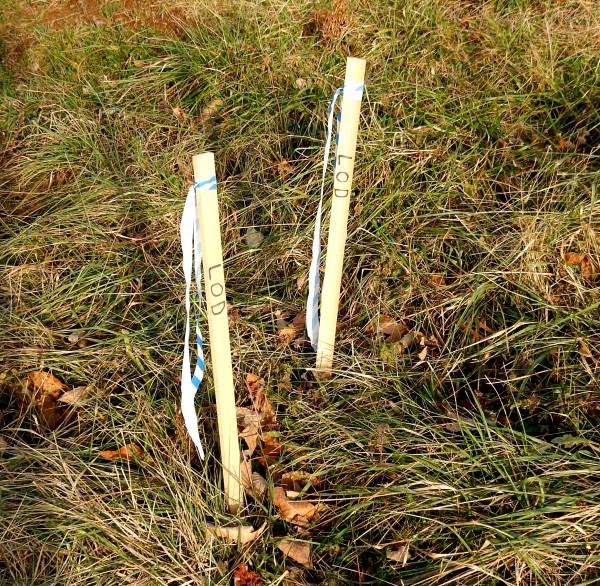
LoD means limits of disturbance. Beyond this point, no trees should be cut, nor dirt moved. The stakes shown here indicate that this is the outside limit of where the contractor will be disturbing the original contour of the surface.
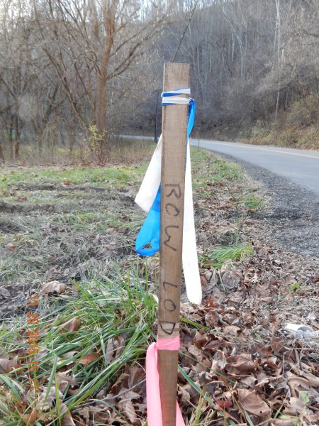
RoW LoD signifies the limits of disturbance of the proposed pipeline right-of-way. Beyond this point, no tees should be cut, nor dirt moved. This could also be used for the outside edge of well pads or access roads or pond locations.
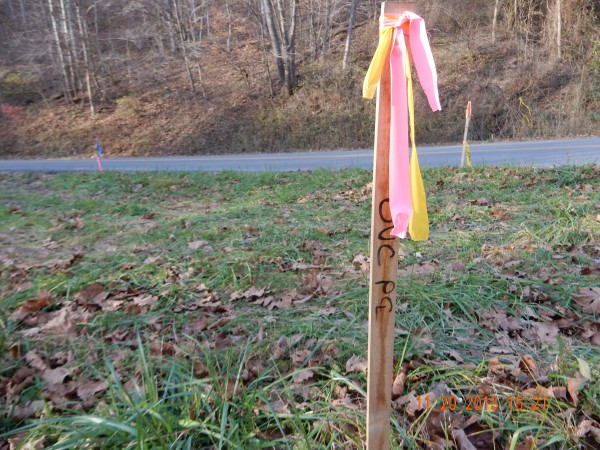
Stakes with flags including a written “C” superimposed over a “L” mark and center line, usually for pipelines.
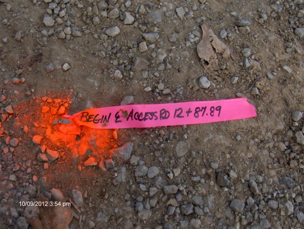
As noted above, stakes with flags including a written “C” superimposed over a “L” mark and center line, usually for pipelines. But, as shown here, they can also be used for future well pad access roads.
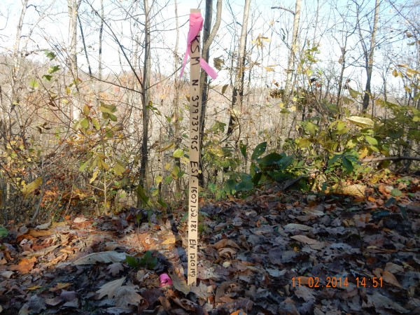
With precise location markings, stakes like this will usually have a steel pin also associated with them. This stake gives the latitude, longitude and elevation of the site.
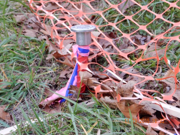
This stake indicates permanent property lines and corners of property; it’s a one-inch steel rod with an aluminum cap.
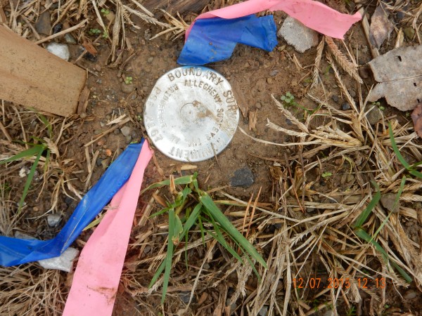
A boundary survey monument indicates permanent property lines, or corners of the surveyed property. This is likely an aluminum cap on top of an one-inch diameter steel bar.
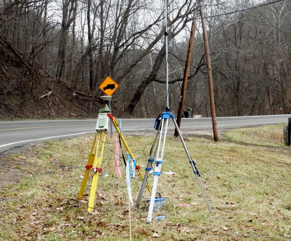
Surveying instruments here are a Leica System 1200 differential GPS. These units are extremely accurate and will transmit to a survey receiver a long distance away. This equipment will frequently be set up near an existing control point. This is shown on the proposed path of the Ohio Valley Connector pipeline.
All photos here by Bill Hughes.




There is a 12 foot wide ditch (canal) , 6 ft deep. , running 1000 ft along one side of my property. The surveyed property line is in the bottom center of the ditch. My neighbor’s land is cultivated fields:; my side is immediately mature pine & oak. Someone has come onto my property and painted a long purplish blue stripe on several of my large trees near, but not on, the ditch. I see this blue strip as I approach the ditch. What does it mean?